How to catch the rain
While fire ravages our hills every year, we keep wondering how we can capture all that rain that our hills are famous for. The answer is quite simple, says Ezra Lawanker Rynjah
The hills are at a very crucial juncture of biodiversity, where plants and animals from the west, meaning drier and much more arid peninsular India, meet those of tropical south-east Asia. For example, the lowland rainforests around the southern slopes of these hills, such as near Mawsynram and Sohra, have been documented to host the greatest number of plant species of any rainforests north of the Tropic of Cancer, that is, outside of equatorial rainforests.
Apart from these rainforests, we also have broadleaved forests of the lower elevations, towards the Garo Hills and Ri Bhoi, and the pine-broadleaved mixed forests of the plateau tops, which are all equally important. These forests are host to several animal species, ranging from humble, but ecologically important, cicadas, bats and rodents to large forest gardeners such as elephants and hornbills.
Furthermore, forests provide us with a range of benefits that many of us who reside in these hills have availed of, such as local herbs and medicines, forest fruits, and, crucially, the water that literally springs from their sponge-like soil.
This relationship between forests and water has given us the association we make between Shillong and the pine tree that was first described here in the Khasi Hills – Pinus kesiya or Khasi pine.
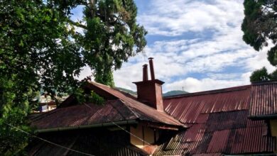
The pine forests that we see around Shillong, the ‘pine city’, do not actually grow as clustered naturally; they were planted in an effort to arrest erosion and protect important water sources around the city. This is true about Lum Shyllong or Shillong Peak, which was afforested when British colonists were here in the early 1900s.
Now known as the Upper Shillong Protected Forest, it is the source of multiple major rivers and the lifeblood to many of our localities, even beyond Shillong city limits. This is true of other forests too, like the one extending from Shyiap to Mawpat, the Itshyrwat Reserve Forest, the Riat Khwan Forest along the old Guwahati-Shillong Road, and the plantation at Mawlynrei.
A telling feature of this history of plantation is how you have trees that are all the same height and girth within these localities; something worth noting the next time one is in these forests. Another notable feature of these plantations is the fact that almost all of them will have pockets where broadleaved trees such as dieng ngan (Schima wallichi), soh phie (Myrica esculenta) or a Khasi oak (Quercus griffithi), are growing underneath the trees and start reaching the canopy, while there will be patches which are completely devoid of small trees, only showing an even-height shrub layer. This evenness of the forest understorey is evidence of how the forest is “stuck”; it can’t change from a plantation to the richer broadleaved forest that it potentially could be.
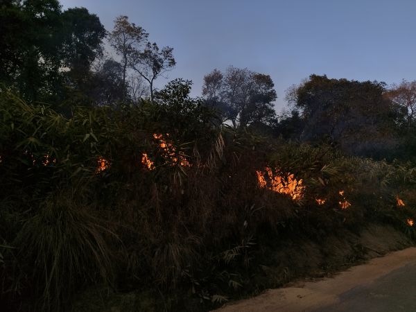
 Active fire near Mawsynram. Photo by author


Now, this is true for many forests around these hills of ours. In fact, in places where such stands have not been planted, such as at Laitlum, we don’t even have trees — one can notice how our grasslands are also very even in stature, like there’s been someone going around with a lawn mower, clipping the grass to size.
If one were to start seeing this, a reasonable question that follows is, “why?” Why do we have this strange even height and size of our trees, or our grasslands? Why do they seem stuck, when some places don’t seem to be – such as the Risa Colony section of the Upper Shillong reserve forest, or the trail head at the Rhododendron Trek near Shillong Peak?
A general answer to this would be some form of disturbance, like a lawn mower or livestock, or a severe frost, or, more importantly in our case in the Khasi-Jaintia hills, repeated ground fires that occur every single year in the driest months with the strongest winds, from February to April.
Pine plantations are particularly prone to these fire events because of the fuel load provided by dry pine needles. I have personally observed up to four fire events in the Shyiap-Mawpat forest in a single fire season because, after every fire, the wind would cause more needles to fall from the trees and add more fuel to the forest floor.
Grasslands or denuded hills are also susceptible to fire events because of how dry they get.
There can be severe frost events in December and January, which completely dry up the grasslands, coupled with a long dry winter, creating ripe conditions for a creeping ground fire that consumes everything in its path, including any tree saplings.
While there are other uses of these forests that cause us to lose them slowly but surely, like unsystematic logging for timber or charcoal, or lopping for firewood, these fires are particularly pernicious because they not only destroy all chances for a forest to recover from the aforementioned pressures, but also physically change the soil on which such forests could potentially grow.
Fire, at any intensity, makes soil more hydrophobic. What this means is that soil is unable to absorb water, so it’s easily carried away, leading to more erosion. This also implies that there is less water retention in an area, leading to an increase in runoff and a decrease in groundwater recharge.
Armed with this knowledge, we can now see this spiral of forest loss that pervades our hills. Firstly, a patch of land is degraded or deforested through logging and lopping. Then there are yearly fires that prevent it from regenerating. These fires make the soil hold less water and make it more prone to being eroded by water.
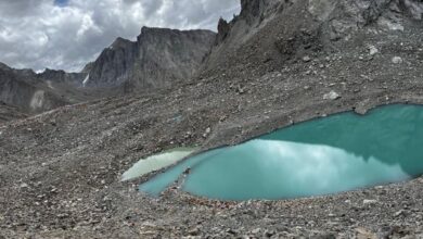
The fire season is immediately followed by the heaviest rainfall in the world, causing the umsaw or red water we see in our rivers – soil simply being washed away downstream. What this implies is that we have less soil for vegetation and forests, which actually increases the porosity of soil so that it can hold more water, and keep the land moist over a longer period, even through the dry season. Having soil that retains moisture would give rise to the perennial streams that we desperately need in our Khasi-Jaintia hills.
We can see such soil in the Lawkyntang at Mawphlang. The forest is a wonderful example of customary protection of forests by people in the Khasi-Jaintia Hills for the sake of the greater good – water security even through the driest winters. However, it pains me to say that despite multiple romantic claims of the closeness of the Khasi or Jaintia tribals, like myself, with nature, we have abandoned that relationship for short-term material gains.
We are currently clearing parts of the Upper Shillong Protected Forest for money in the form of tourism, while people in Shillong have to purchase water for their daily needs. No new Lawkyntang are being made despite the desperation for water we have every dry season. Fire ravages our hills every year, but we keep wondering how we can capture all that rain that our hills are famous for.
The answer is quite simple – tend to the land, protect it from fire and grazing animals, and let the vegetation that comes up do the rest. It is known that vegetated soils become like sponges, arresting erosion and slowing down the release of water. It would do us well to remember the wisdom of our ancestors and work with nature rather than against it.
(Ezra Rynjah is a scientist working at Conservation Initiatives)
Banner image by Matthis Volquardsen on Pexels (https://www.pexels.com/photo/brown-open-field-2305169/ )