

Meghalaya lacks plan to stop rain risks
Despite a thorough report on risk & vulnerability assessment, govt is taking no action to stop landslides & floods
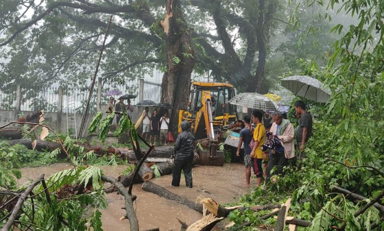
The pre-monsoon rain for the last few weeks has created havoc in many localities of Shillong and several districts in Meghalaya, causing immeasurable damages to property and lives. There were numerous cases of landslides which disrupted life and livelihood to a great extent. This, however, is not the first time that the state is experiencing such damages. As the monsoon arrives each year, cases of cave-ins, inundation and land slips become rampant.
According to a risk and vulnerability assessment report — jointly published by UNDP, USAID and the Centre — the municipal areas in the city are less prone to landslides as compared to its neighbouring areas and the approach roads to Shillong, which lies in seismic zone V. The vulnerable position of the hill city is reason for frequent tremors which, coupled with heavy rain, can act as a trigger for landslides.
The landslide vulnerability has increased in the recent past due to “unplanned and unscientific” development, deforestation, choking and blocking of natural drains, poor road construction, encroachments on steep hill slopes and unstable slopes.
According to the report, some of the vulnerable localities in Shillong are Madanrting, Nongrimbah, Lawsohtun, Happy Valley, Lumsohra, Laitumkhrah, Mccabe Road, Bethesda, Arbuthnot Road, Wah Kynrud, Raid Laban, Um Saw, Lumparing, Jackson Trace Road, MES Road and Sericulture Farm.
Slope angle is the principal causative factor for landslides and it can be calculated and spatially illustrated from the Digital Elevation Model. The steeper the slope, the higher is the risk of landslide due to the higher gravity-induced shear.
Land use is another important factor influencing the occurrence of landslides. Frequently changing vegetation cover often results in modified landslide behaviour. Various investigations find that land use, especially of a woody type with strong and large root systems, helps to improve the stability of slopes.
“The dense forests along the NH-40 have smaller diameter pine trees as compared to the other areas with pine trees of larger diameter. Smaller diameter pine trees might also accelerate sliding since larger diameter trees have more roots and so have the capacity to maintain the water and soil pore pressure during heavy rains,” the report pointed out.
Landslides are closely associated with spatial patterns of rainfall and its intensity. Shillong is divided into three zones depending on the rainfall intensity. Ranking of each rainfall zone is done based on their susceptibility to landslides.
Where’s the plan
Though the report was exhaustive and published years back, its reflection is barely seen in the city planning where many houses are built precariously on steep slopes and close to streams, making them vulnerable to landslides.
There were several instances of houses being washed away during the rains. It is surprising that urban authorities gave a go-ahead to the blueprints of these houses. Also, rampant felling of trees for mindless construction has made the slopes more susceptible to landslides.
The ill-planned drainage system and lack of civic sense among citizens have led to clogging of drains, hindering easy passage to rain water. This often leads to flash floods in lowlands like Polo and in its vicinity. The phenomenon takes place every year and yet there is no concrete plan to solve the problem.
Shillong generally receives an average annual rainfall of about 144.39 cm and the strength of the southwest monsoon in a year depends on the frequency, the tracks and the strength of synoptic systems such as monsoon lows and depressions. More than 50% of the city is exposed to extreme flood risk and climate change could “exacerbate the flood intensity and frequency in this district with more intense rainfall spells.
Studies conducted by the Intergovernmental Panel on Climate Change (IPCC) had suggested that the proportion of rainfall from heavy will increase in the 21st century in some seasons. This could contribute to the rise in local flooding in some regions, the IPCC findings show.
As the effects of climate change are felt each passing year and every season, there is an urgent need for the authorities concerned to take note of the risk assessment report and overhaul their development plans, especially in the heavily populated urban areas. There has to be proper slope gradient study before urban bodies sanction a building plan. Their negligence will only lead to more hazards and loss of innocent lives.
~ Team Sunday Monitor